
This post is going to cover the ins-and-outs of hiking the Mt. Edziza Transverse (Buckley Lake to Mowdade Lake). There is very limited information on the internet, so my dad and I put together this to help those planning a similar trip with the information we would have liked to have known beforehand! Feel free to comment or message me any questions you may have.
Information:
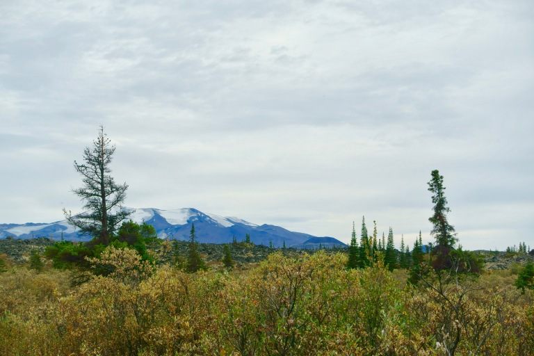
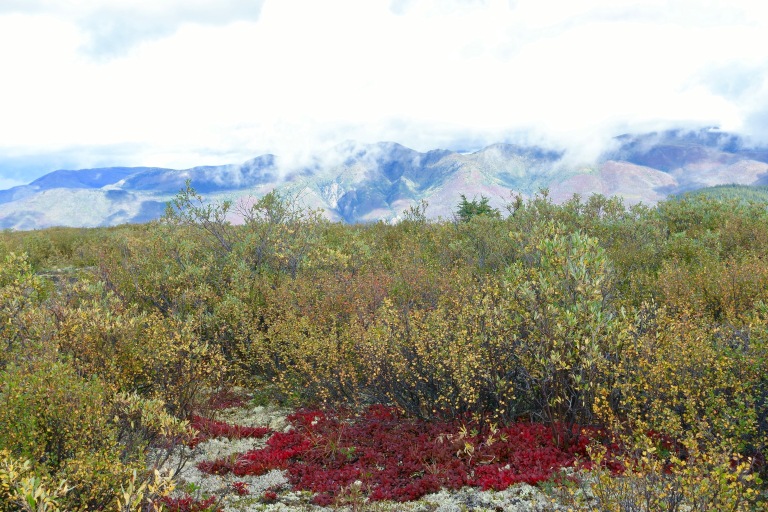
Mt. Edziza Provincial Park is a beautiful and vast remote park in northern British Columbia, just south of the Yukon Territory. It contains wildly different landscapes and habitats hundreds of Grizzly Bear, Black Bear, Moose, Caribou, Wolves, and many other creatures. It is a volcanic complex consisting of over 30 dormant/potentially active stratovolcanos, cinder cones, shield volcanos, calderas, and lava domes. It also includes Canada’s tallest volcano, Mt. Edziza.
How We Got There:
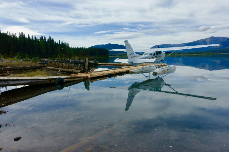
Coming from Seattle, it took about a 1.5 days worth of traveling to get into the park. Our route was flying Seattle –> Vancouver, B.C. –> Smithers, B.C., then rent a car and drive about 6 hours (501 km) up to Tatogga Lake, stay the night in the motel there, and take a float plane via Alpine Air out of the lake in the morning into Buckley Lake (20 mins). We then got picked up by Alpine Air at Mowdade on our last day and began the journey home.
[You can also helicopter in, but you will be paying a pretty penny for the convenience]
[Also, we highly recommend Alpine Lakes Air]
*Alpine Lakes Air is the most reliable float plane company, but never count on being on schedule. Our flight into the park was delayed by several hours because of an emergency in another park. Our flight out of the park was lucky because a pilot needed to make a drop off at Mowdade and was 27 flights behind due to weather, and luckily had space to take us back. BRING SPARE FOOD just in case you have to wait a few days.
Overview of the Hike:
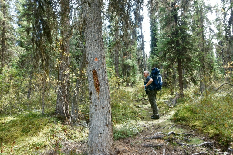
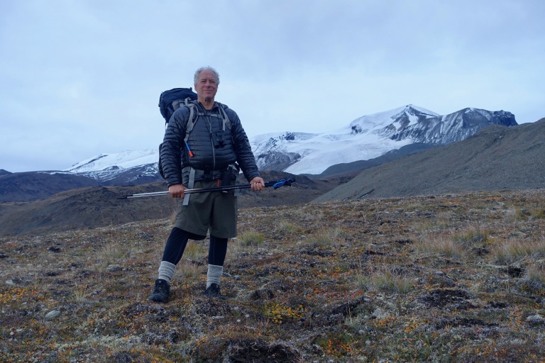
This hike is NOT for inexperienced hikers. In fact, you should only do this hike if you are very experienced backpacking in harsh conditions and navigation, or you are with someone advanced enough to guide you. You also need to have adequate gear, and realize that much of your gear will get destroyed in the process of this hike due to sharp lava rock, swampy, and muddy conditions. At the end of this article I include the gear list my Dad put together, and whatever else we felt like we could have used if we were to do it again.
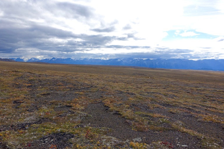
The trails are well marked near Buckley and Mowdade, but in between it can be difficult to find your way. Even near the lakes the trail can be overgrown, easy to lose, and are no where close to being even decently maintained. While you are on the volcanic plateau, in between the lakes, you will follow cairns. The cairns are scarce and not easy to spot without a decent pair of binoculars, and serve more as an affirmation that you are headed the correct direction than as a guide.
- Time of year:
- June 20-Mid September is considered the best time to hike this transverse, as summer is short in Edziza.
- Even during this time of year expect snow, hail, and freezing temperatures at times.
- Day by Day Itinerary:
- Online it is hard to find out how long this hike is, but we found our Delorme said we walked about 68 miles total. This is how our days ended up working out:
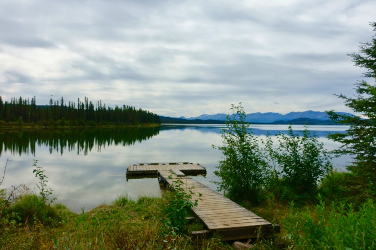
- Day 1: Buckley Lake to Willie Williams Camp
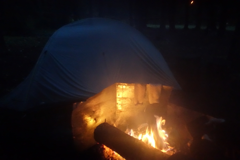
- This is just short of 6 miles, and an easy day. We lucked out with some good weather too. The hike is a gradual uphill hike through forest. We had some swampy areas, but nothing compared to what was ahead! You will know when you show up to Willie Williams camp because it is an established horse camp, with a fire pit, poles to hang food, and a table to eat at! Enjoy the luxury while you can, and make a nice warm fire.
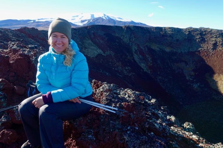
- Day 2: Willie Williams Camp to Eve Cone
- This was probably only around 7-8 miles, but we had terrible conditions. Cold sleet downpour and low visibility. We ran into a few folks on their way to Buckley. To escape the wind and rain we found some shelter near Eve Cone and hunkered down attempting to stay warm.
- We got lost and had to do some serious bushwhacking. Near Sidas Cone, the trail splits into two–take the RIGHT trail, NOT the left to avoid this mistake.
- Day 3: Eve Cone to 2 miles before Sezill Creek Camp Site
- We woke up and summited Eve Cone while some of our gear dried out in the cold sunshine of the morning. Then took off and did about 10 miles. We went around the right of Black Knight Cone (aka Tescone Ridge) and made it about 2 miles before Sezill Creek Camp Site before calling it a night.
- Expect a lot of river crossings this day!
- Day 4: 2 miles before Sezill Creek to Coffee Crater
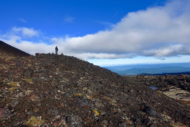
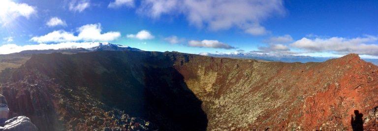
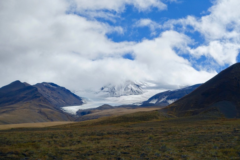
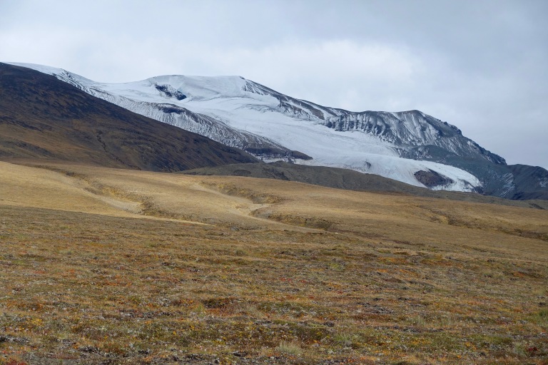
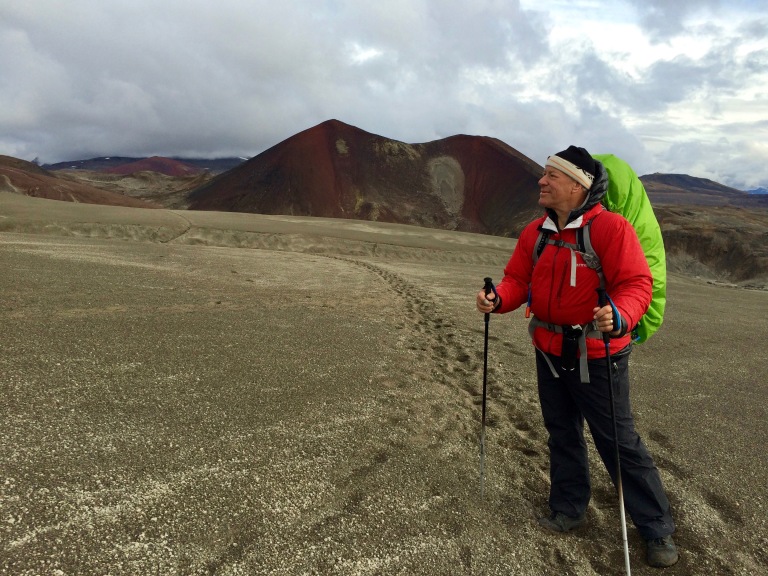
- This is a challenging day. About 10-12 miles. You will cross some creeks, gain some elevation this day, and actually cross a glacier as well. Keeping Edziza on your left, you will come across first, the magnificent and symmetrical Cocoa Crater. You’ll now be walking on ashy sand. Keeping Cocoa on your right, you will curl behind it and enter a river valley in which you must be very cautious as you will be on the glacier without even knowing it.
- The trail is easy to see as you follow the footsteps in the sand. DO NOT FOLLOW JUST ANY FOOTSTEPS. Make smart and informed decisions about where the safest route is. I got in a dodgy/potentially life threatening situation because I followed footsteps into a gulley that my dad had to rescue me out of.
- You will then go up and over the glacier. The main trail lead over a literal crack in the glacier, that was idiotic to follow–so we found a new route over a more secure part of the glacier.
- You will then see the magnificently colorful Coffee Crater! We hiked down a dry riverbed to camp at the base to escape the cold winds coming off the nearby glacier.
- Day 5: Coffee Crater to Chikama Creek Camp
- We woke up to some snow, and tried to wait it out before starting our hike, as it was advised not to go over in bad weather. Around noon we got started and thought we would check it out and if it was impassable we would camp at the base until we could go through. In our opinion the pass was very easy, and could have been done in even slightly worse conditions. You don’t gain much elevation going up, but you do lose a lot going down. Some steep and exposed areas but very manageable.
- You’ll follow Chikama Creek all the way down to your campsite. The trail was very flooded and the mud would swallow your entire boot–sometimes up to your knee. You will be in a beautiful forest with small pine trees and dense vegetation–very refreshing after being in the ash for several days.
- There is a horse camp about a mile before a normal camp, we suggest the normal camp because it has a better fire pit and tent pads.
- Day 6: Chikama Creek Camp to Mowdade Lake Camp
- This day is not fun compared to the others. I believe its about 12-15 miles and be prepared to trudge through deep mud and water.
- The trail is very obvious for most of the day, execept when you encounter the beaver ponds. When you enter these beaver ponds, try to go straight across to find the trail again, don’t go wandering around the beaver pond looking for an alternative.
- Keep your eyes on the prior footprints because losing the trail means bushwhacking through dense vegetation.
- You’ll start to see signs when you’re within a mile from camp. Camp has a metal bear box and a fire pit. Enjoy!
- Day 1: Buckley Lake to Willie Williams Camp
- Online it is hard to find out how long this hike is, but we found our Delorme said we walked about 68 miles total. This is how our days ended up working out:
SUPPLY LIST:
- Bear Spray
- Bear Bangers
- Solar charger
- Normal Charger
- Binoculars
- Duct Tape
- Cameras
- Sun Glasses
- USB Cables
- Long Underwear
- Smart Wool Sweater
- Smart Wool Jacket
- Buff
- Pants
- Underwear
- Shirt
- Sun Tan Lotion
- Bear Proof Container
- Rope
- Food
- All season tent
- Sleeping Bag
- Sleeping Pad
- Head Lamp
- Towel
- Hat
- Soap
- Toothbrush and Paste
- Map
- GPS & Satellite Tracker
- Hiking Poles
- First Aid, Advil and Painkillers
- GoPro
- Drone
- Plastic Map Protector
- Plastic Phone Protector
- Compass
- Knife
- Lighter
- Passports
- Coffee
- Spork
- Coffee Cup
- Data Storage for Backup
- Water Bladder
- Water purifying tablets
- MSR Hyperlight water pump
- Emergency Blanket
- Backpack
- Hiking Boots
- River Sandals
- Batteries
- Socks
- Pants
- Suntan Lotion
- Benadryl
- Bug Lotion
- Mosquito Net
- Waterproof Gloves
- Hat
- Rain Gear
- Down coat
- Underwear


Such fun reading your blog and seeing all the photos….looks so beautiful, and your adventure seems to be an exciting one…..Thanks for the arm chair view of your trip. Love Nancy
LikeLike
Sarah this looks awesome I really like the picture of you guy’s on the cone!
LikeLike
Great trip & nice meeting you two – enjoyed the report and video!
LikeLiked by 1 person
Great detail – Many thanx!!!!!. Would like to do the trip next summer
LikeLiked by 1 person
No problem, if you have any questions feel free to reach out!
LikeLike
Thanks for the blog, now I want to attempt this hike!
LikeLike
Awesome! Let me know if you have any questions–thanks for reading!
LikeLike
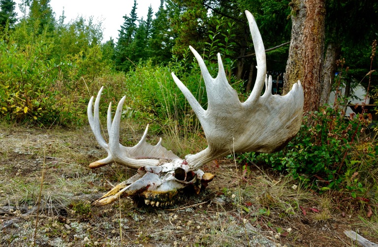
that was a great article and awesome pics! My wife and i flew into Buckley May 21,1989 with the intentions of skiing Edziza and some of the cones,as we flew over our route it became apparent that Edziza is in the rain shadow of the coast mts…very little snow. So we just hiked around for a week,saw many cariboo and moose,i think they were calving.I recognise the camp with the antlers,our dog was licking its paws and i realised his pads had worn off from the ash.It was at the end of the trip and she was a border-collie cross mutt and not large so i carried her to Buckley.We flew into Buckley from Telagraph creek and our pilot wasn’t so reliable…he forgot to pick us up…we were out of food(we should have left some at the cache at Buckley with our ski gear) after 2 days we were preparing to hike to Telagraph creek when he saw our truck in the parking lot and had a ‘holy crap” moment and picked us up just as we were hiking out. Anyway ..again thanks for sharing your adventure with your Dad
LikeLiked by 1 person
Hey, thank you so much for sharing, these are great shots and information. We are just researching this hike for this coming summer, thinking of doing the whole 10 days…
I was wondering where you got a trail map, if you had one? I have located topo maps for the area, but no trail? I am super excited to go up 🙂
Sarah
LikeLike
It was immensely difficult to find any trail maps besides the few vague ones posted online. My dad went and mapped it all via GPS, but the trail is very straight forward until you hit the plateau. But then again on the plateau it is so wide open that a trail is not really necessary– as you just walk with landmarks in mind. We mapped our entire trip using our GPS, I will update the article when I can get my hands on it and upload our trail.
LikeLike
That would be great! I would love to have the coordinates for this summer as well! This seems like too awesome of a trip to not take
LikeLiked by 1 person
Thank you for all the details! It’s always awesome to see this kind of information on a hike instead of just the BC Parks pamphlet lol. I am thinking about tacking either this or the Monkman lake trail (again) but all the way to Hoi’s cabin.
LikeLiked by 1 person
Taylor, email me at finesar000@gmail.com , I will send you the file with he waypoints, as I am unable to send through these comments. Forgive my delay, I was out of town for quite some time– hopefully it is still helpful to you.
LikeLike
Great pics. My daughter, her fiancé and I did the Buckley to Mowdade hike in late August of 2016. I’m a professional forester and have worked and travelled all over BC. This is undoubtedly the most off—the-grid place I’ve Been. We encountered two groups of Tahltan hunters and two groups of hikers in our 6 days there…. that’s it. We had a hailstorm like none I’ve seen, not round opaque pellets, but angular shards just like broken window glass.. even one of the native hunters said he’d never seen the like, his horses were trying to hide under each other! But the Caribou, wolves, colours and obsidian boulders made it all worthwhile. It’s a fair lace that’s hard to describe… but “Mordor” comes to mind in some me parts…. and yes, I’d do it again.
LikeLiked by 1 person
It was really interesting to see your photos and read about your hike. In 2005 a friend and I did the entire hike on foot, from the end of a logging road off of highway 37 south of Kinaskan Lake, right into Telegraph Creek. We went the opposite way, south to north. It was absolutely the hike of a lifetime!
LikeLike
Hello! Just starting to research a potential trip into Mt Edziza area this summer and was very glad to come across your site and the information you have provided. Thank you for this comprehensive source of more detailed information and for sharing your experience.
LikeLike
Hello, Mark! Do you have a map of this hiking trail? Or maybe you can recommend something? Becouse we plan to do this hike without plane. Thank you
LikeLike